MICHIGAN TRIPLE TIP
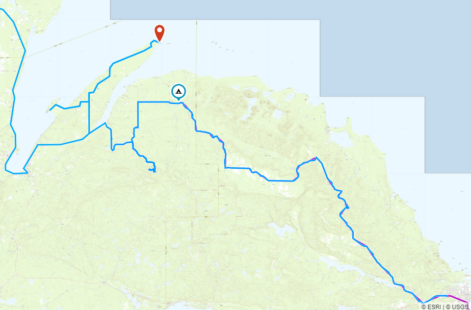
Overlanding Route in Michigan's Upper Pennisula, derived from the 7 Hour Plane Crash route with additional segment into the Huron Mountains.
The Background
You could say that this route has been in the making for many years, I spent many summers through my childhood with my Dad bombing around the seasonal and back roads of the UP, in the most unlikely of vehicles, mostly mini vans. A large majority of this was in the Huron Mountain area to the north and east of Marquette stretching over to the Huron Bay, and into and up the Keweenaw Peninsula.
So, 25 years later when I came across the route for the 7 Hour Plane Crash, running from Crandon Wisconsin to the tip of the Keweenaw I knew exactly how to add a day or two of additional travel and exploring to our very first Overlanding adventure. Finding a route into the Huron Mountains, my old stomping ground was obvious, and it kept us moving east, back toward home. So it was an easy addition.

The Setup
Like so many things several factors came into play all converging on a spot in my life that ended up propelling me out into my first ever Overlanding trip. I have always liked to take off down some two track road and see what was there, drawn by the unknown. And I'd done a lot of it here and there. But never have I set out with as much planning, desire and equipment!
I'm a traveler, the last 7 years of my life I've visited someplace in the world at least once a month, I'm fortunate that I do this travel for work. When COVID lit up and travel my company issued mandatory travel bans I was actually in California on my way home. That was in February, as the weeks of no travel wore on I knew I needed to get back out into the world somehow.
A buddy of mine recommended a show to watch, Expedition Overland and I was hooked on the adventure and the exploring through the unknown, and far away places. Then, my lease was called in and I was offered an early lease termination do to the shortage of used cars. Now I had an opportunity to order a new car, the one I wanted and have it setup in a specific way. A trip was starting to form in the back of my head I just didn't know it yet.
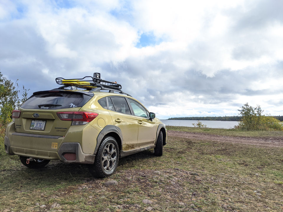
The final factor was, stumbling across a Youtube video done by @Wanderlost (https://youtu.be/9WVWKWgllkk) of the 7 Hour Plane Crash. That was all I needed, a route setup with a review that lead me to be pretty confident I could do this in my Subaru Crosstrek. As I dug into it deeper, I discovered that not only could I do this route, but people were doing a lot more in their Subaru’s.

Day 1 - Heading North
Leaving from West Michigan in early afternoon we headed on up to Iron River and spent the night there at the Lakeshore Motel on Ice Lake, a great little Mom and Pop hotel on the east side of town just off US 2. The weather was not good, and in fact somewhere on US 2 cutting across in a thunderstorm and the dark we ended up hitting a tree that was down across the road. I saw it in time to get mostly moved out of the way, and the only impact was on my mirror which popped the plastic but didn't do any damage, and that was before we were even off pavement!

Day 2 - 7 Hour Plane Crash, Crandon WI to Bob Lake Camp Ground
After a restful night of sleep, and a good breakfast at The Main Street Cafe in downtown Iron River, we were headed west out of town on the way to 73 to head south to the starting point in Crandon Wisconsin. As you cross into Wisconsin 73 turns into 55, as we came to the 55 junction with 32 we found that the road south to Crandon was closed, the detour took us up to the same road we were going to come north from in Crandon, so we opted to just go ahead and start just north of Crandon, dropping off the pavement shortly after turning onto forest road 2174.
Day 2 - 7 Hour Plane Crash, Crandon WI to Bob Lake Camp Ground
The first 30 miles or so was all gravel road, a great start with a lot of fall color to enjoy as we went. We snaked north through the National Forest on the gravel roads making good time till we hit pavement again on County Road A for a few miles, till we made our turn north on Kaine Lake Rd.
The trail that heads north west from the end of Kaine Lake Rd. I had gotten some information on so I was prepared for what it could look like, it's a river crossing, or from what I could tell in videos more like a river and the trail converging for a bit. Especially with the amount of rain that had fallen in the area the 3 days prior we were prepared to have to go around, and that is what we did. Once we drove up to the end of Kaine Lake Rd, the two track was pretty easy to spot, as was the water that was running down the ruts on both sides of the two track. I knew, based on video from a week earlier and how high the water crossing was then that my Subaru wouldn't be making that water crossing on that day. We headed back out to County Road A, headed west to Mail Route Road, and within a couple of miles meet back up with the route and continued north. Route in blue shown to right.

Day 2 - 7 Hour Plane Crash, Crandon WI to Bob Lake Camp Ground
Our stopping point for lunch tuned out to be a bit more eventful than we had originally anticipated. After breaking out the sandwich supplies, I suddenly became aware of a hissing noise from the rear of the car. It was coming from somewhere on in the tread, but although I could feel the air, I could 'find' what was in the tire. When we lifted it up on the jack, the air stopped hissing, and when we put it back down it didn't return. At that stop we were unable to locate the leak after that, although we knew it was their. We topped the tire off to get back to our running PSI and after lunch were back on the tail.
We would later discover that our assumption was correct, what was in the tire was in fact a very small, and very sharp rock fragment, what they referred to as 'mine rock' at the Tire Shop in Hancock, and with no weight, or in different positions the tire was sealing around it. It never lost more than 2 PSI the rest of the day.
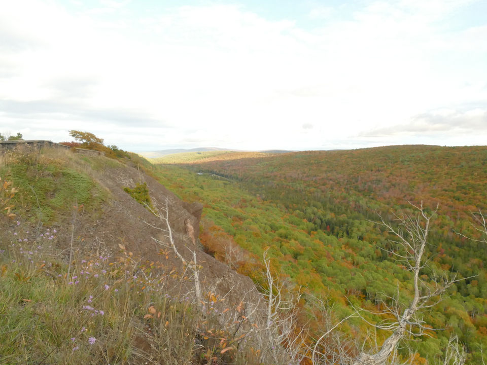
The remainder of the day was spent primarily on forest service roads, we definitely encountered more water, but that was to become the theme of our trip, water, water every, where! The entire day we spent in areas of peak color and it was a fantastic start to our trip. Among our noted stops for the day were the Lower Dam Lake, which is a former lake (and had some really fantastic camp locations to take note of) and the dam and the value house and everything is stil intact. Very neat to see, also was cool to see an old island protruding. So that is on my list of places to hike over to if I'm ever in the area again!
Sidnaw was our designated 'decision point', from here we were going to decied where to camp based on the time of day, how well we'd been progressing etc. When we set out in the morning, we really didn't have any idea what our average speed would be and how far we'd actually get. I had some estimates, and they turned out to be reasonbale. From Sindaw we pushed on north, on the 7 Hour Plane Crash Route, which to the Bob Lake Campground, which was a great little National Forest Rustic Campground.

Day 3 - Bob Lake to Tip of the Keweenaw
The morning brought rain, and with it a hasty pack up and camp tear down. Our tent, which was old and used had some structural issues before we set out. It didn't fare well in the rain but we didn't really know the extent of it as we packed up. We also knew we had a tire leaking air, when we got into camp the night before, I’d checked it multiple time and could hear no air escaping. However, on a check in the morning before we set out, we were down to under 12 PSI. We finished packing aired the tire up and set off.
Our game plan for the day was simple, We knew we had about 15 miles to the series of bridges on the Bill Nicholls Trail, we didn't want to miss those. After that, we were going to see what the trail was like. Some reports were the ORV trail got rough the further north you went. With our tire situation the secondary objective, right behind the bridges was getting to Hancock to have the tire repaired by a professional. The close third goal, was make it to the first of our three tips!
The first 8 miles again were forest road till we hit a spot on the map labeled as McKeever, there is nothing really there in reality, it's a label and nothing more. But here we were able to get onto the Bill Nicholls ORV trail which was great trail in this section. We did encounter several large downed trees, but fortunately they had all been cleared, although a few had been cleared very recently. The three bridges were very much one of the highlights of the trip and should not be missed, although they are not part of the original 7 Hour Plane Crash routing that is posted by the original author. I would highly recommend you take the Bill Nicholls and hit the bridges!
Another 8 or so miles up the trail they did start to get really rough, and we choose to abandon the trail for M26 and run in to Hancock to have the tire looked at. The Tire Shop was able to get us in and the tire repaired and we were back on the road in about an hour. Since the ORV trails are restricted north of Calumet, and we'd already lost some time due to the tire repair we choose to stick to US41 headed north, although we did take the Cliff Drive bypass. We arrived into Copper Harbor around 1pm. Knowing a lot of our gear was still going to be wet we were able to get one of the rustic cabin at Trails End Campground which are just fantastic. We unloaded, laid things out to dry and go ready to head out to the tip!
Clearing the pavement at the end of US41 is sort of a 'end of the world' feeling I think, and was another cool part of what we were doing here in the UP. I'd been up this way earlier in the summer with the family and we visited Horseshoe Bay, which is also a neat area. But as it was getting later in the afternoon, we had our goal in mind. We made decent time till we made the turn onto High Rock Road. After the two water crossings the road gets rougher, the puddles longer but not necessarily deeper. After working through a lot of puddles we came out to the tip at High Rock Bay, meeting the final objective for the day.

The Cabins at Trails End Campground
The Cabins really were fantastic and have a really handy and cool solar power setup with USB charging ports and a 12V DC port for things, such as our 12V Color, which we were able to power from 2pm in the afternoon through till we left at around 10am on the solar battery system. The whole camp site was really neatly done, so if you’re in the area yes, camping out on the tip is an experience I'm sure, and one of these days we'll do it. But staying at Trails End would be high on my list when I return.
Once we got things dried out and had a good look at the tent, it was determined that the tent was not salvageable, it's a long story but it had been well used over the years, so I'll be looking for a new one!



The original plan was for this day to end in the Huron Mountains and for us to camp at Big Erics Bridge, at the State Campsite there. However, since we were now without a functional tent, our choice was to either push all the way to Marquette, or after completing out objectives to head back to L'Anse. We didn't really want to head back west, just to head east in the morning for home. So we set out, the plan was to make the call from the top of Mount Arvon based on the time it was and the likely time it would take from there.
But, before we could leave the Keweenaw there were some required stops, The Jam Lady in Eagle River is a required stop if you are passing through and we couldn't pass back through Calumet and not stop at Toni's for a Pasty.


We continued on pavement till we got north of L'Anse and started up the Pt. Abbaye Rd, the first several miles of road are nice fast and smooth gravel, but it starts to narrow in after a bit as you head further towards the tip. The road is well passable, and you spend a good deal of time coming in and out of views of Lake Superior. The tip has a nice parking area, picnic area and rustic bathroom. The actual tip is accessible currently and there even looked to be a dispersed camping site that has been used on the east side of the tip.

